|
|
Fuzzy overlay
Fuzzy modelling of the world
Suitability analysis aims to find sites or regions that satisfy particular geographic criteria, such as vegetation types, land use or terrain characteristics. We consider a use case to illustrate the idea. The hypothetical alpine village of St. Gittal seeks to identify potential habitats for the reintroduction of wild living wolves. Let us assume that wild wolves prefer rocky and densely forested sites far away from human settlements. Overlaying the wolves needs and the properties of the available land, environmental scientists and decision makers can identify the most suitable sites for the predator.
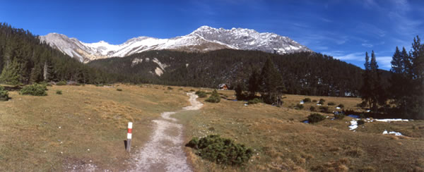
 Panoramic view of the alp Stabelchod in the Swiss National Park. Photo Ronald Schmidt
As a first straightforward GIS operation, one could use Boolean overlay of binary data layers. Sites suited for the wolf could be selected by intersecting the features "forest" AND "rocky" AND "unsettled". In the resulting view of the world, sites could only be suited or not suited, a further subdivision like "fairly suited" or "not very suited" would be impossible. Refining the overlay operation by assigning different weights to the single data layers increases the sensitivity of the query. Performing such a weighted overlay allows, for example, the land use "unsettled" to be 2.5 times as important as the vegetation type "forest".
A major problem with Boolean as well as weighted overlay is that both assume that the input data layers correctly represent reality. Due to sparse sample points and error-prone measurements,
this condition is rarely met with natural geographical phenomena. Nature may not fit into crisp point, lines and polygons
or smooth and continuous fields. For instance, how could the patchy mosaic of an alpine meadow ever fit precisely into ten
vegetation classes, for example? This unit introduces the concept of fuzzy overlay to handle such uncertainty and vagueness. ![]() Fuzzy membership functions (FMF) permit entities to be partial members of different, overlapping attribute classes. The unit allows you to explore different
aspects of fuzzy overlay working on various interactive animations illustrating the wolf habitat use case.
Fuzzy membership functions (FMF) permit entities to be partial members of different, overlapping attribute classes. The unit allows you to explore different
aspects of fuzzy overlay working on various interactive animations illustrating the wolf habitat use case.
Learning Objectives
- You know the difference between Boolean and fuzzy logic
- You know when to use the fuzzy set approach
- You can construct examples of fuzzy suitability analysis
- You can sketch different fuzzy membership functions on a sheet of paper to classify sample points
- You know how to carry out fuzzy overlay in the raster model
