|
|
![]()
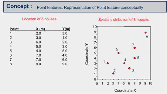
Individual spatial properties of Point Features
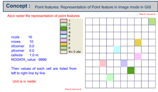
Point features can be described as single x, y values in object mode or single column, row values in image mode.
Example of representation of point features
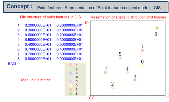
The following graphic illustrates the representation of point features in object mode.
Create point features in point mode and image mode
1. Create a point feature file based on the following table using available GIS system, at your lab.
| PointID | X(m) | Y(m) |
|---|---|---|
| 1 | 2 | 3 |
| 2 | 3 | 1 |
| 3 | 6 | 2 |
2. Create a raster representation of a point feature based on the point feature vector data that you have created above using available GIS system, at your lab.
3. Create an ASCII raster file based on the raster representation of the point feature.
|
|
|
|