|
|
![]()
Spatial pattern and neighborhood of Areal Features
Here we will learn about spatial patterns and neighbourhoods of aeral features. Especially, how to measure the distance among aeral features, how to create a buffer polygon or polygons from aeral features and how to create proximal polygons from the aeral features.
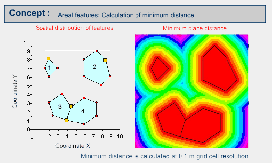
Example of minimum distance calculation from the areal features
The distance value of each cell is not illustrated for the clarity of presentation. The euclidean distance is applied in a similar way to the distance calculation for point and linear features.
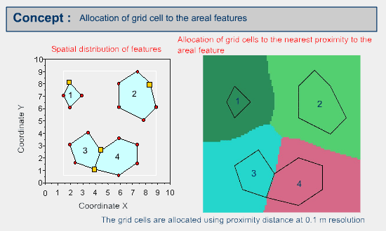
Then the grid cells are allocated to the properties of areal features based on the nearest proximity distance between the cell and areal feature. The result should be similar to the following.
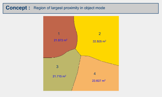
The result can be represented as vector or object mode as the following example.
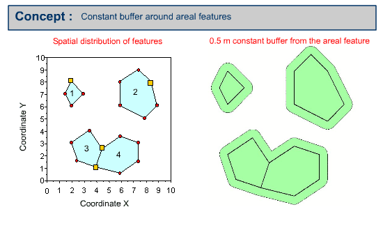
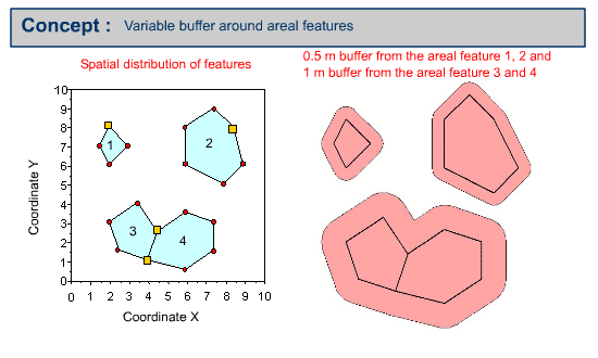
Example of buffering areal features
Buffer polygon or polygons can be created by using a constant buffer distance or variable buffer distance around the specified input areal feature.
Calculate the minimum distance of areal feature (image mode)
- Calculate the closest distance, using the available GIS software from your GIS Lab, based on the areal feature distribution map illustrated. You may choose the resolution of grid cells.
- Then allocate the grid cells to the property of the areal feature, based on proximity using the available GIS software from your GIS Lab.
Create buffers around the areal features
- Create the 0.5 meter constant buffer, using the available GIS software from your GIS Lab, based on the areal feature map illustrated.
- Create the 1 m buffer around the linear feature 1 & 4 and 0.5 m buffer around the linear features 2 & 3 at the same time, using the available GIS software from your GIS Lab, based on the areal feature map illustrated.
|
|
|
|