|
|
![]()
Overlay
The principle of the overlay of spatial data can be illustrated through the example of producing maps. When printing a map, different layers of spatial information are printed one after the other onto white paper. Each color represents new information on the paper: green represents vegetation, blue for hydrography, and red for the signatures representing residential areas. All the colors together give a very detailed model of reality: the map. This is the main basis of overlays in GIS. First, two or more layers of information from the same area are overlaid onto each other. Then, the topology of the new layer is updated: if a point now lies within a polygon, it gets assigned this information as a new attribute. If two lines intersect ("arcs") a new node will be added at their intersection. If two polygons intersect, a unique identification number is given to the intersecting set and so forth. Ultimately, the overlay results in an information gain. In order for this integration to make sense, all input layers must have the same reference system and scale. The map will only be legible if all the layers fit together exactly in regards to position and scale. The process itself is independent of whether a raster or a vector model is used. With a raster model, the overlay operation is rather an overlay than an intersection. The integration of information from various sources through overlay is one of the most important functions of a GIS.
The following three types of overlay are independent of whether a vector or a raster model is used.
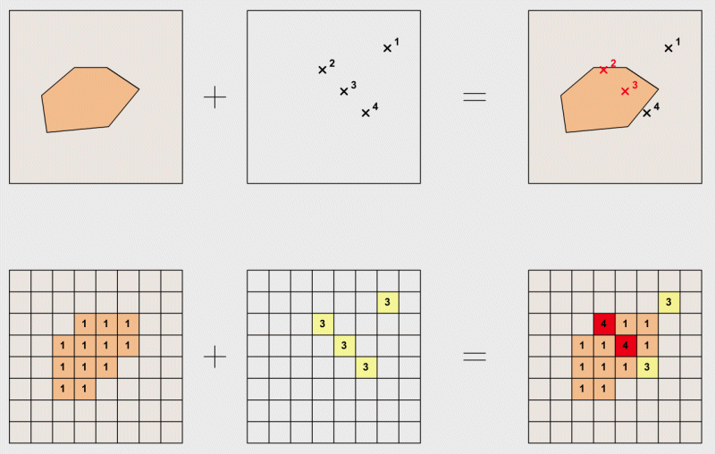 |
Point-in-polygon: in the vector model, this overlay determines the points lying inside a specific polygon. In the example, we are looking for all hotels that are located in the settlement areas. In the resulting layer, the points have the additional information whether or not they are in the settlement area. In the raster model, the points in question are visible through the addition of the two input layers. |
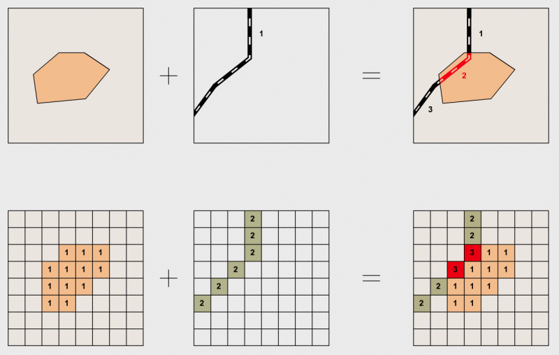 |
Line-in-polygon: the overlay of lines and polygons is more complex. The example shows the calculation of road sections located in the settlement area. In the vector model, the topology changes: the original line is cut into shorter segments by the intersection points. It has to be specified for each segment whether it is inside or outside the settlement polygon. In the raster model, a simple addition identifies the interest areas. |
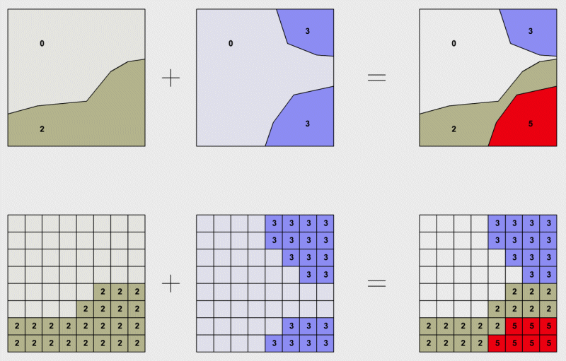 |
Polygon-on-polygon: in the vector model, the most complex case is the intersection of polygons. The result is a data layer with a whole new topology. The overlay of contour lines results in a variety of new intersections and polygons for which the attributes have to be reassigned. In addition, for non-cut areas it has to be checked whether they contain areas of another information layer i.e. whether island polygons were created. Raster overlay is very simple, however. Again, the cell values of the input layers are calculated. |
|
|
|
|