|
|
![]()
GIS tasks: managing data
Geodata collection has a long history. Beginning in the 15th century people started to gather geographic data to create maps, especially for orientation and navigation on land and sea, later on to draw country boundaries and mark off private property and political sovereignty, eventually creating the great traditions in cartography and surveying.
In recent years however, there has been a transition from the classical, paper-based cartographic products to dynamically generated and interactive views of data on the computer. Together with the rapid evolution of information technology, application areas for GIS have widened to new fields such as traffic planning, land use, environmental science, hydrology and many more. It became possible and necessary to collect and store new kinds of data such as population numbers, temperatures, vegetation cover, addresses, etc., in a database, which today forms the core of any information system.
Data types: Raster vs. Vector
In a GIS, we can differentiate two kinds of data: spatial and attribute data. Spatial data simply consists of points in space,
each stored as a pair of coordinates and if needed its height. Geometrical objects such as streets, rivers or country boundaries
can then either be represented by vector data (points, lines and polygons), or by raster data (grid of pixel-filled cells).
Many GIS can handle vector and raster data to give you the advantage of both. The two data types can be transformed into each
other, although the conversion usually involves a certain loss of precision and information. 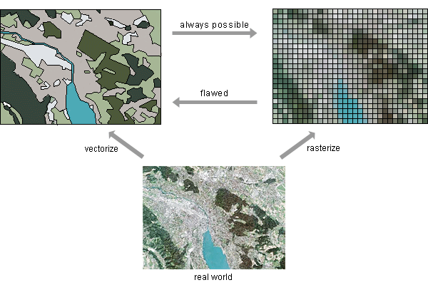
Relation in space: Topology
Often, we are not only interested in where real-world objects are located and how they are represented. We also want to know about their spatial relationships, e.g. their topology:
 |
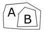
Adjacency: What is next to what? Which parcels of land are adjacent to Zurich Airport and have already been developed? |
 |
Containment / Proximity: What is enclosed by what or how close is something to something else? Which buildings in Bern are inside the identified flood plains and hence susceptible to flooding by the Aare? |
 |
Connectivity: What is linked to what? Which river sections are downstream from Basel and hence likely to be polluted by an accident in the chemical industry? |
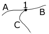
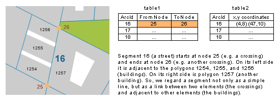
While a computer-aided mapping system may represent a road simply as a line (arc/segment), a GIS may also recognize that road as the boundary between two buildings and two other roads. This allows for example "path finding" operations.
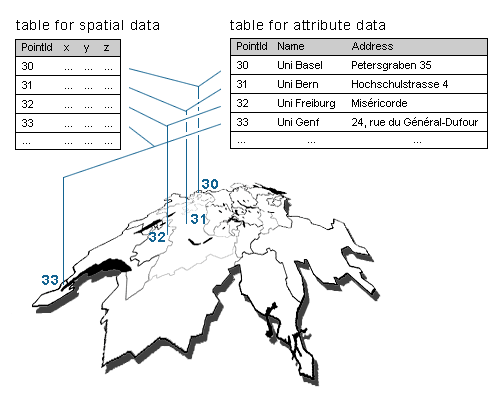
Any other non-spatial data is considered as attribute or thematic data. Attribute data is always stored with a reference to the spatial data. The following example illustrates this concept with universities. They are represented here by single point locations. In a single record, each point has associated with it not only its exact location but also information about the university, such as its name, institutes, number of students, and so forth.
Acquiring data
Before any data can be managed, analysed, and visualized, it has to be acquired. Geographic and related attribute data can be either collected in-house or purchased from a federal or commercial data provider. For a long time, capturing digital data ment digitizing it manually from existing paper-maps using digitizer tablets and a mouse. In general, manual digitizing is a very work-intensive and error prone method, and the data quality is (in the best case) just as good as the map that was digitized. Nowadays, software tools that automatically extract features from satellite images, aerial photographs or already existing maps are gradually replacing what has traditionally been a very time-consuming and expensive digitizing process.
|
|
|
|