|
|
|
|
|
|
Thematic map using point symbols
Definition
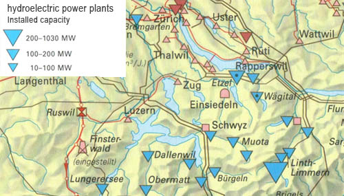
In this type of maps, phenomena are represented by point symbols which are located as accurate as possible regarding their topographic position. Strictly designed maps of this type only show qualitative differences. However, quantitative aspects are often represented by the size of the symbols. The following figure shows an example.
 Source: (Spiess 2004)
Point symbols
There is a countless number of different point symbols. Nevertheless, three different types can be distinguished:
- Geometric symbols
- Pictographs
- Letters and numbers
Explanations and examples of thematic maps using point symbols are shown in
the following interaction.
Selection of the symbol form
The aim is to design the symbols as small as possible in order to avoid overloading of the map and to allow a highly accurate placement of the symbol. On the other hand the symbol must be large enough in order to provide a good readability which allows the user to recognize symbol variations in its colour and form. The choice of the symbols is closely linked to the purpose, scale and content of the map. The four following rules provide support in the selection process.
Combination of different symbol types
Often different symbol types are used together. The following figure shows an example of a thematic map in which all three symbol types are used. Click on each type to show the corresponding legend.
